Remote Sensing
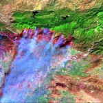
Remote Sensing and GIS techniques aid greatly in natural resources management and sustainable exploitation of natural resources. MMC has worked with many commercially available satellite data products including IKONOS, QuickBird, SPOT, ASTER, IRS and Landsat, has extensive expertise in satellite image interpretation and processing. Some of the applicatons of Remote Sensing are-
|
Our Services |
Contact Us
99, 1st Floor, MB Road (Next to Basist Complex) ,Khanpur, New Delhi 110062
|
Services
GIS Application Development
|
AchievementMMC ISO 9001:2008 NewsletterA moment of immense proud and prestige arouse after levels of churning and grinding. |
Follow Us
We are all time available in our Social Media Networks for supporting our customers. Feel free to post your feedbacks on our links below. We will happy to see your feedbacks and will be in touch regularly.
|
Copyright © 2011 - All Rights Reserved - Multimind Creations